[ Home ] ► Documentation to Rock Samples collected near Impact Craters on the Canary Islands
► Rock Samples from Tenerife & Gran Canaria ► Rock Samples from Fuerteventura & Lanzarote
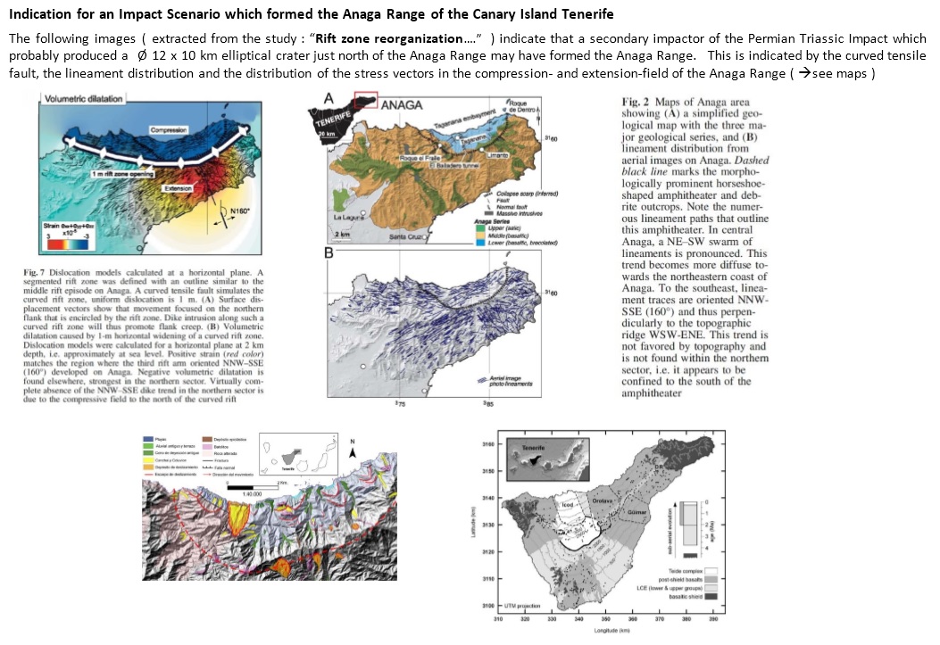
Images & Weblinks from interesting scientific Studies : ► Indication for an Impact Scenario which formed the Anaga Range ► these studies provide further proof for a impact scenario !
( see images further below ! ► scroll down this side to see the images ! )
► Description of the : Impact Craters on the Canary Islands ► as PDF : Europe_Italy & Spain Impact Event.pdf
The map on the left is a manipulated gravity anomaly map which shows the assumed arrangement of the Canary Islands shortly after the PT- Impact Event ( ~ 200 Ma ago )
Possible elliptical secondary impact craters caused by the PT- Impact Event are marked on the map ( > negative anomalies / blue & pink )
The map on the right is a gravity anomaly map which shows the location of the Canary Islands today.

► Rock Samples from Tenerife & Gran Canaria ► Rock Samples from Fuerteventura & Lanzarote
