
[ Home ] [ Back ] The 1270 x 950 km Permian-Triassic Impact-Crater_Summary of the geophysical evidence
as PDF : Part 6b : ► Summary of the geophysical evidence for the Ø 1270 x 950 km Permian-Triassic Impact Crater
also read Part 6c : ► Supplement document to the geophysical evidence__with probability assessment of the existence of the PT-Crater
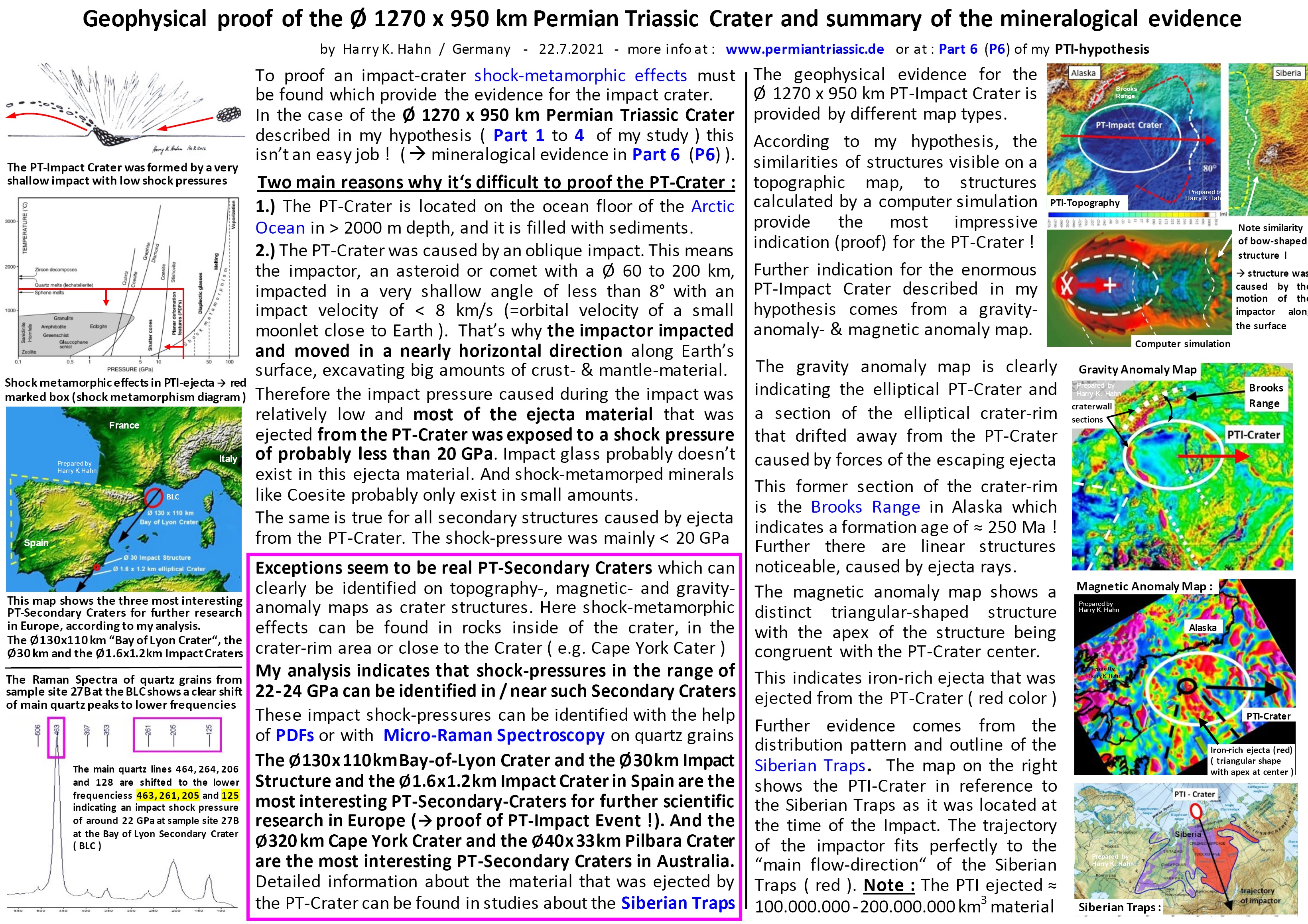
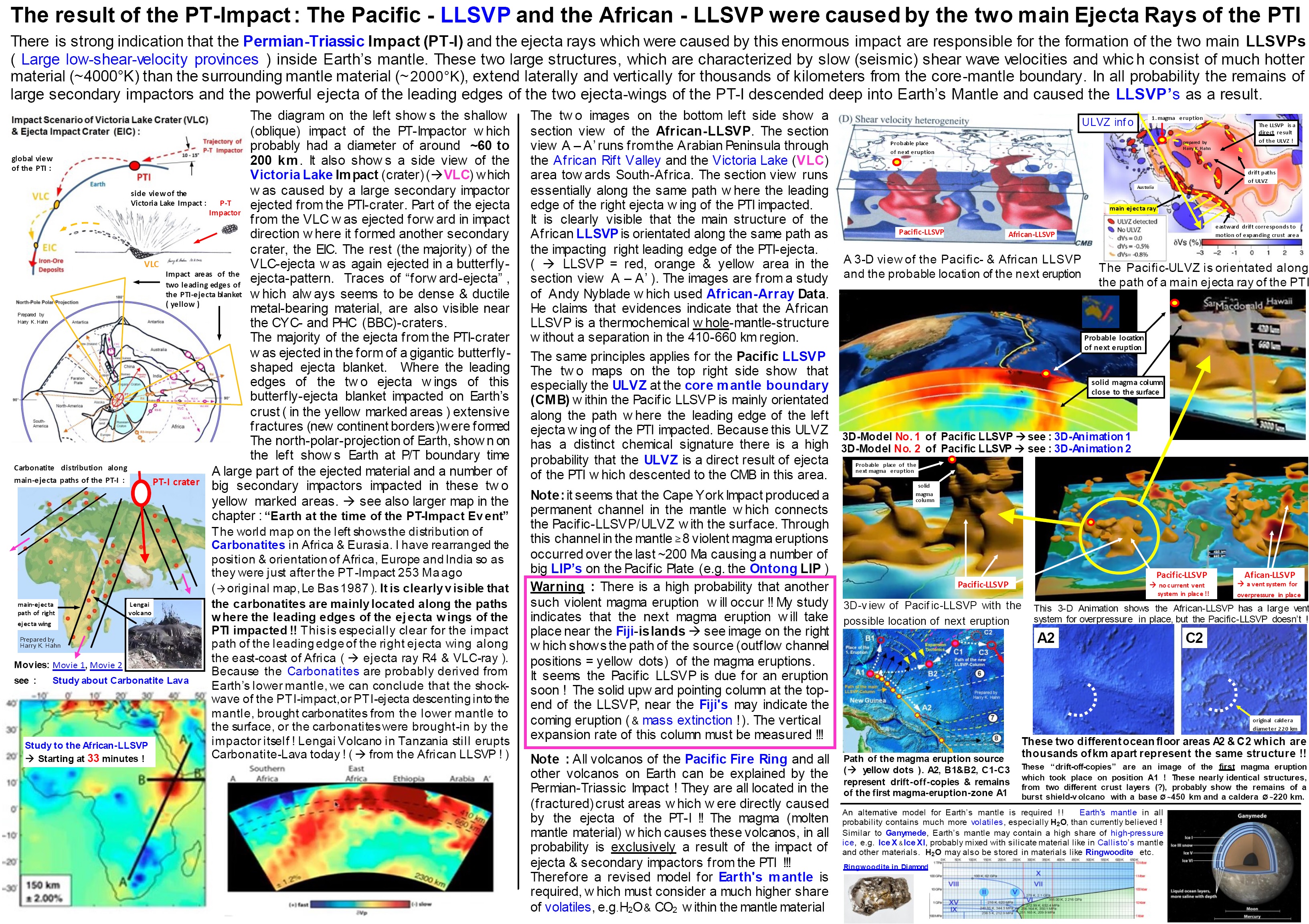
This is a summary of geophysical evidence for the Ø1270 x 950 km Permian-Triassic (PT)-Impact-Crater which I have discovered and described in my hypothesis Part 1-6.
See also Part 6c which supports the proof of the PT-Impact, and which indicates a "multiple-oblique impact" that also formed the Tarim-Basin (China), Pantanal Crater (South-America) & Victoria Lake Crater (Africa)
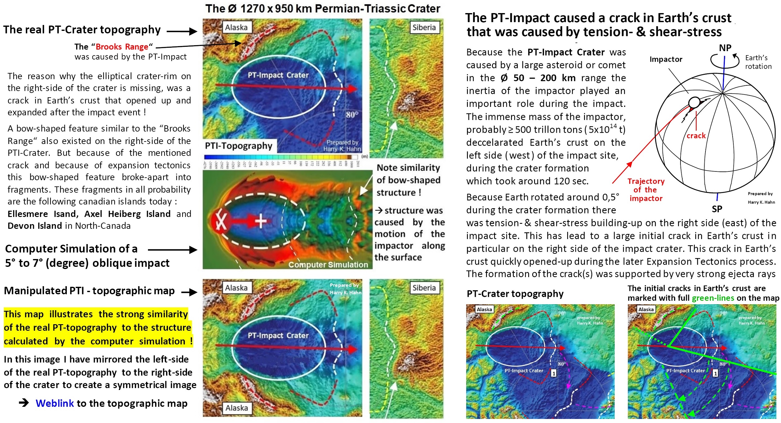
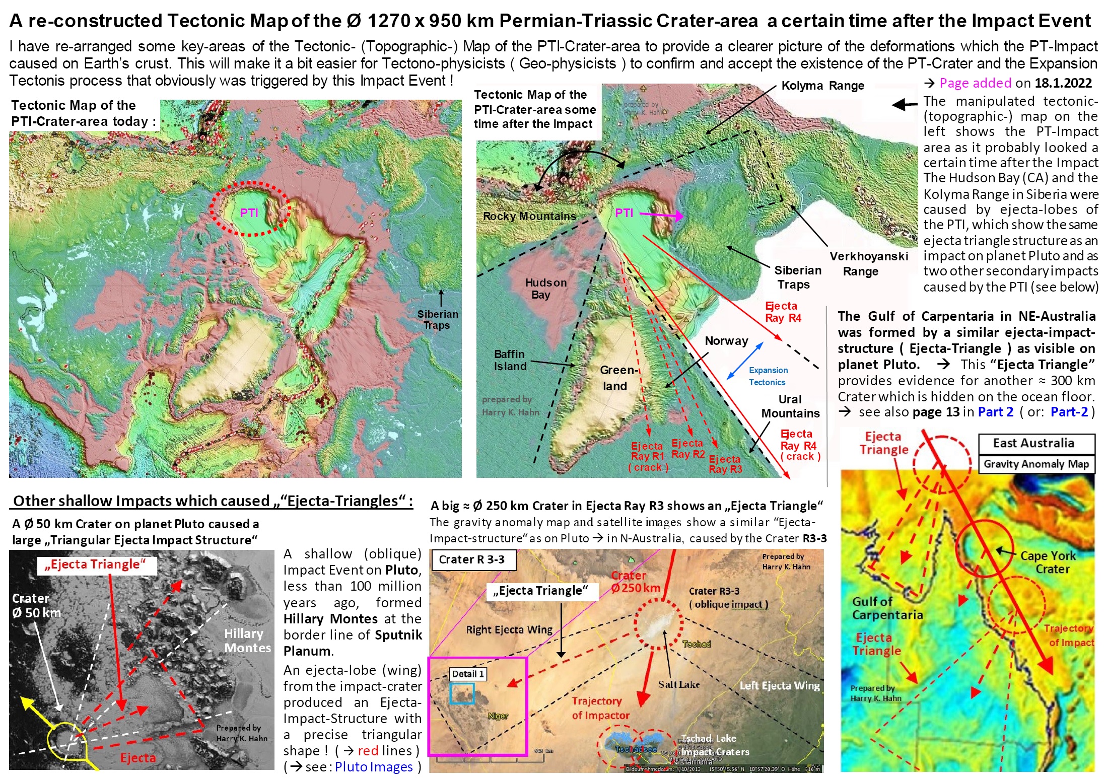
A topographic map and a satellite image of the Arctic Ocean area, Alaska and Siberia provided the first indication for the PT-Impact Crater and –impact event.
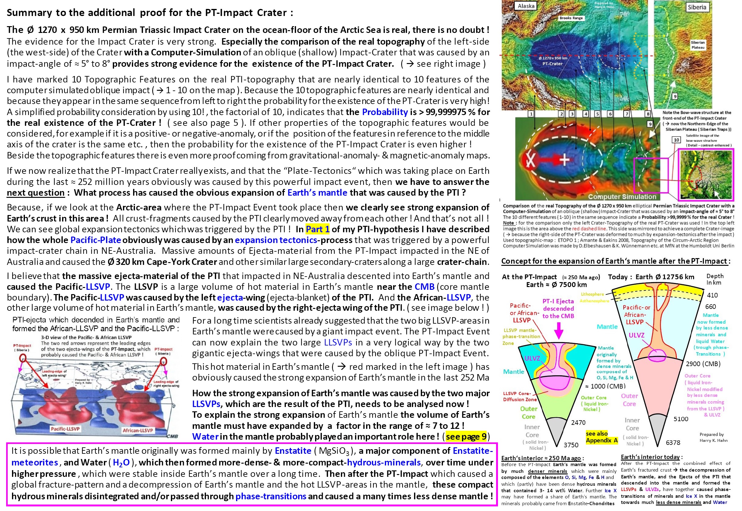
The similarities of structures visible on the topographic map to the structures calculated by a computer simulation of a shallow (oblique) impact with an impact angle of 5°, provide a strong indication for the existence
of the Ø 1270 x 950 km PT-Impact-Crater on the Arctic Ocean floor.
Especially the elliptical deep sea basin in the Arctic Ocean, the bow-shaped Brooks Range in Alaska and the northern edge of the Central Siberian Plateau (Siberian Traps), which has the same bow-wave-structure
like the calculated structure, are strong indicators that the PT-Impact Crater was caused by a shallow impact of an asteroid or comet.
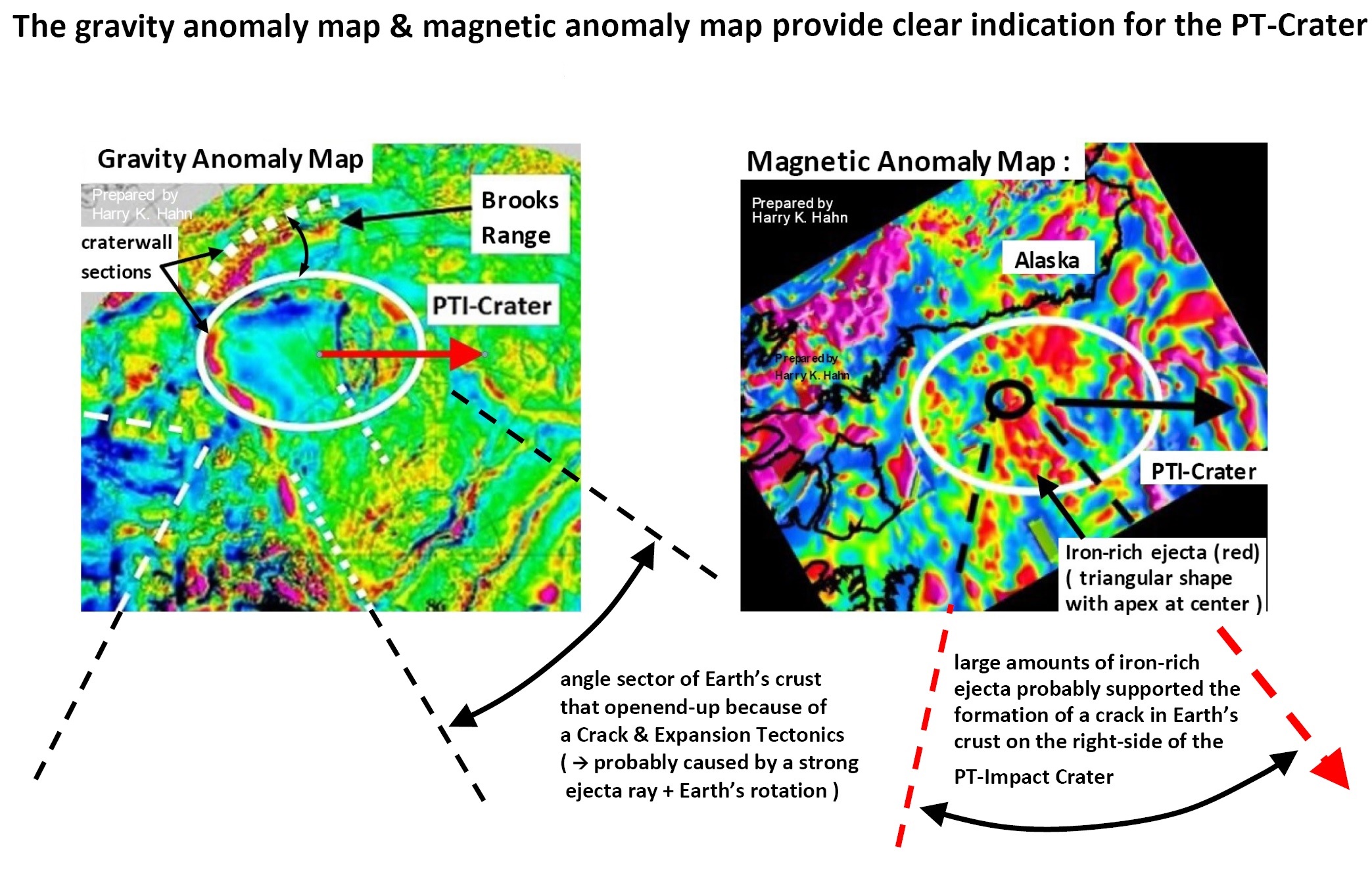
Further strong indication for the PT-Impact-Crater comes from a gravity anomaly map and from a magnetic anomaly map of the Arctic Ocean area and Alaska. The gravity anomaly map clearly shows sections of the
elliptical crater-wall of the PT-Impact Crater ( positive anomalies (red) ). The Brooks Range in Alaska, which originally was part of the elliptical crater-wall-structure, is also indicated by a positive anomaly on the map.
This section drifted away from the PT-Crater, caused by forces of the massive amounts of ejecta material that was ejected from the crater, which probably was in the range of 100.000.000 to 200.000.000 km^3
of ejecta-material !
The magnetic anomaly map of the Arctic Ocean area shows a triangular-shaped positive anomaly (red), which originates from the crater center. This indicates ejecta that was coming from an iron-rich impactor.
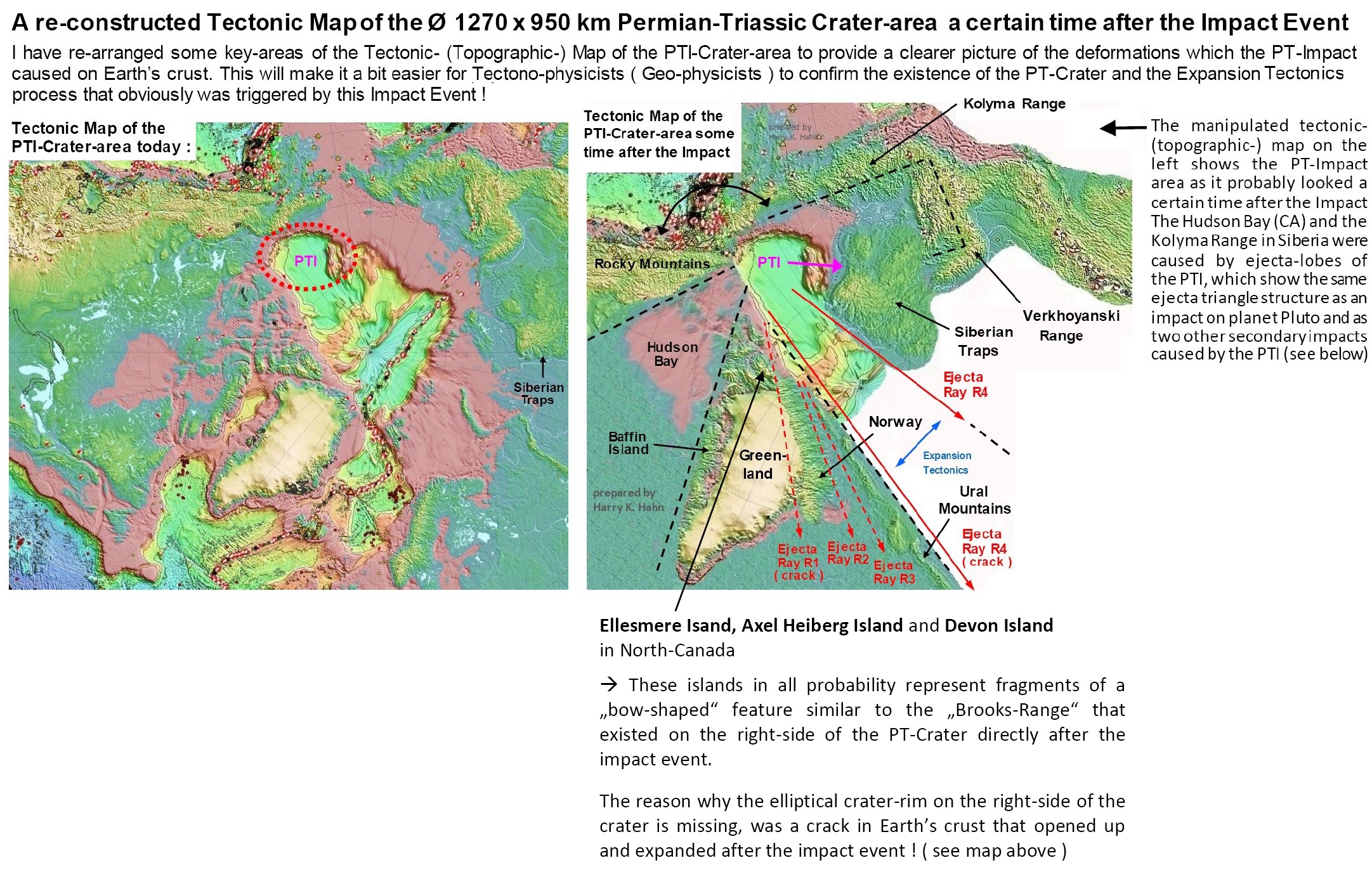
The big distance between the elliptical impact basin and the described bow-wave-shaped structure in Siberia, which originally was located directly at the front-end of the PT-Crater, is the result of a divergent tectonic
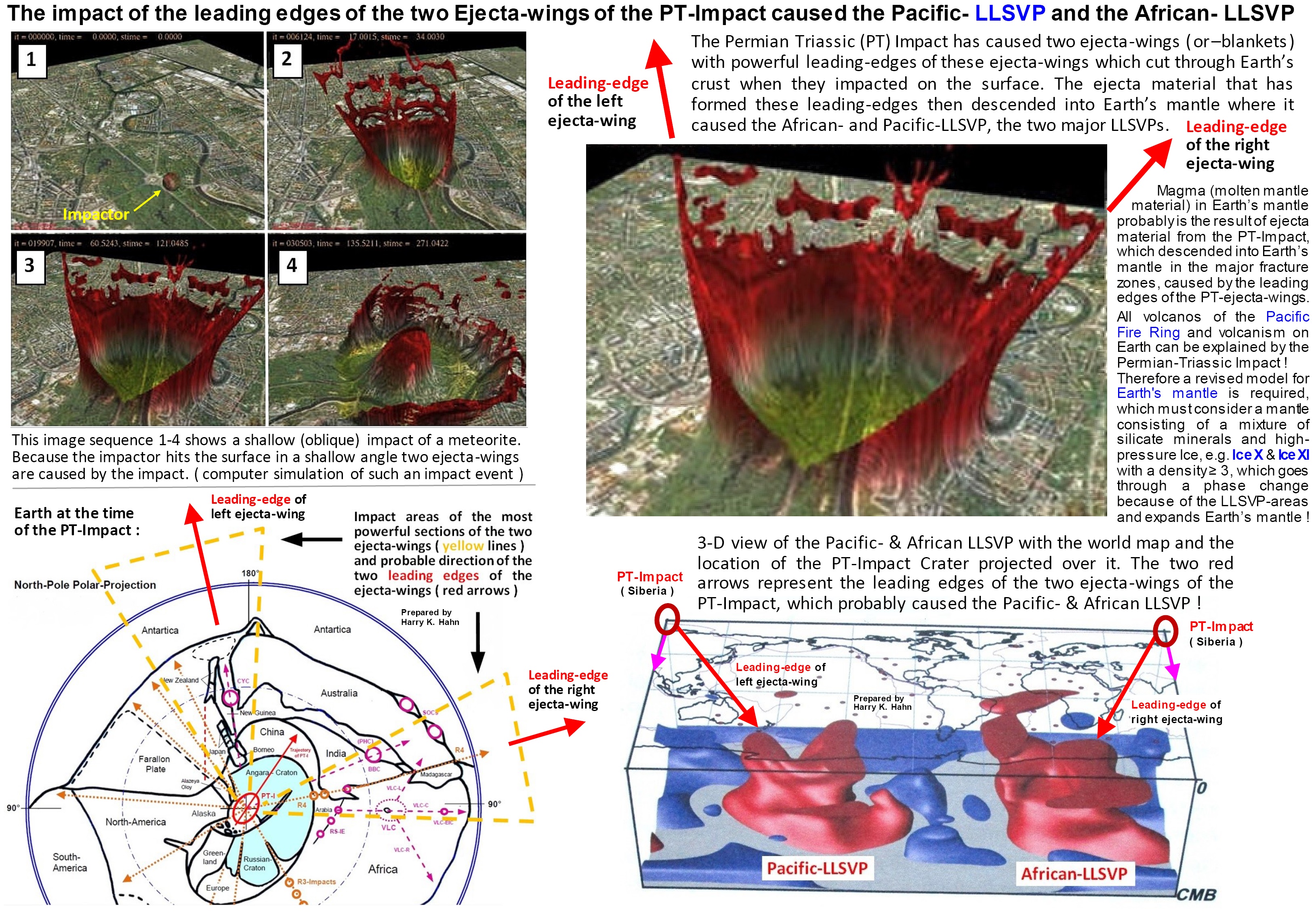
motion and expansion tectonics process that was triggered by the shallow PT-impact. The leading edges (front edges) of the two gigantic ejecta wings which were caused by the PT-Impact, cut through Earth’s crust
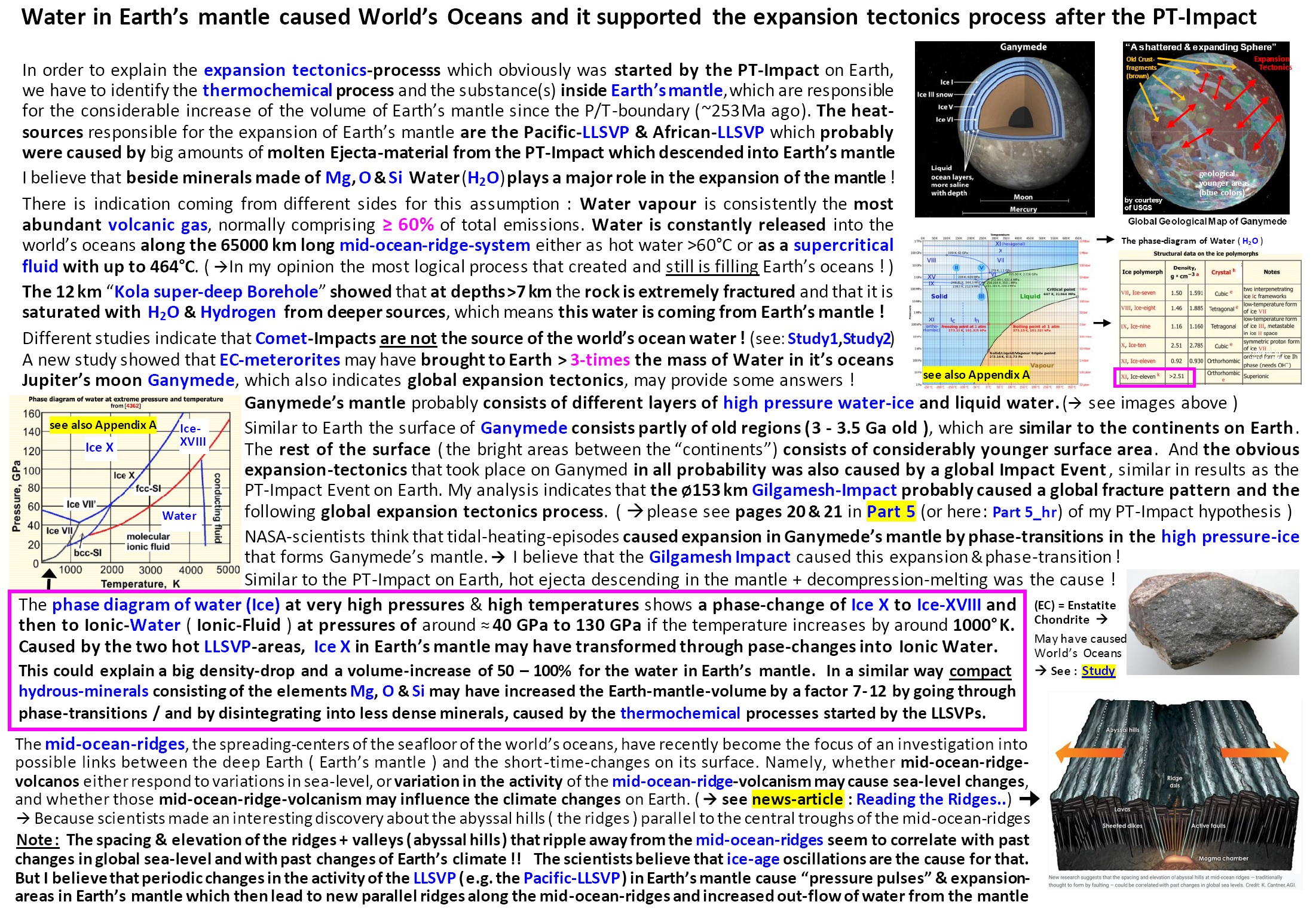
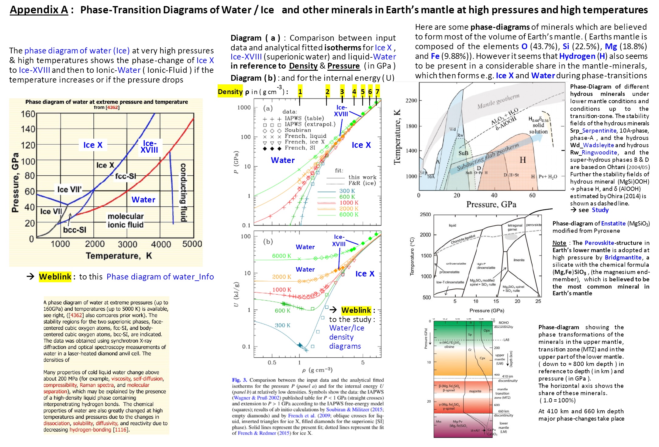
and large amounts of impactor material (e.g. iron) and ejecta material descended into Earth’s mantle and caused the Pacific-LLSVP and the African-LLSVP.
Note : All volcanos of the Pacific Fire Ring and volcanism on Earth can be explained solely by the PT-Impact !

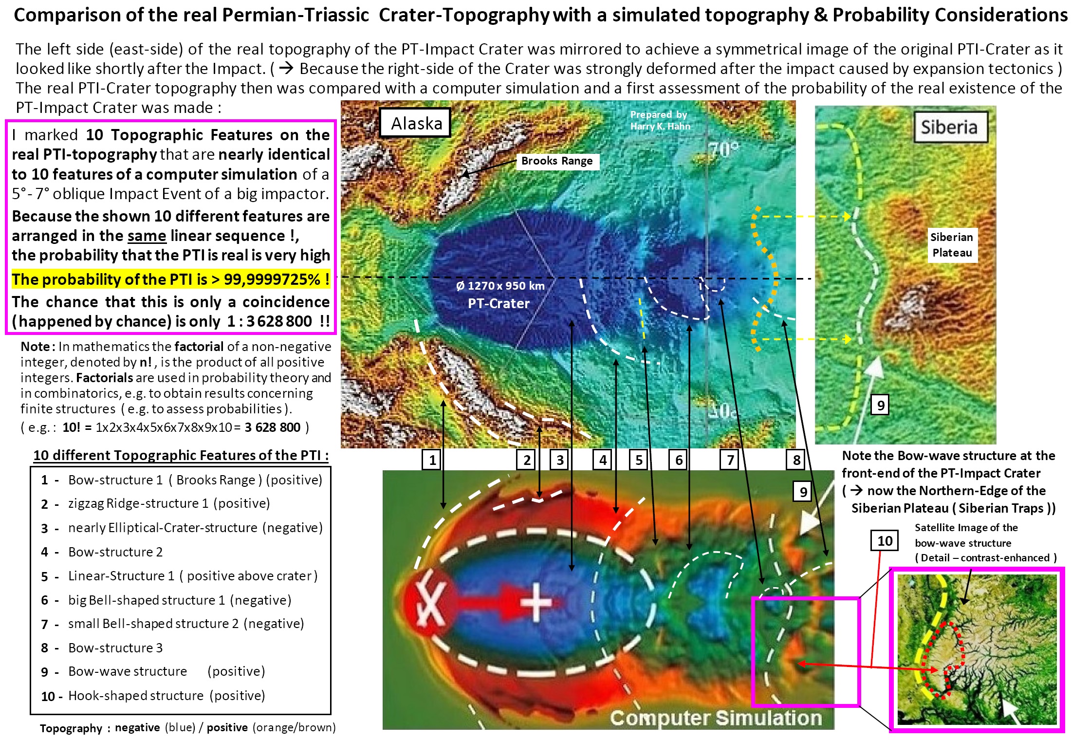
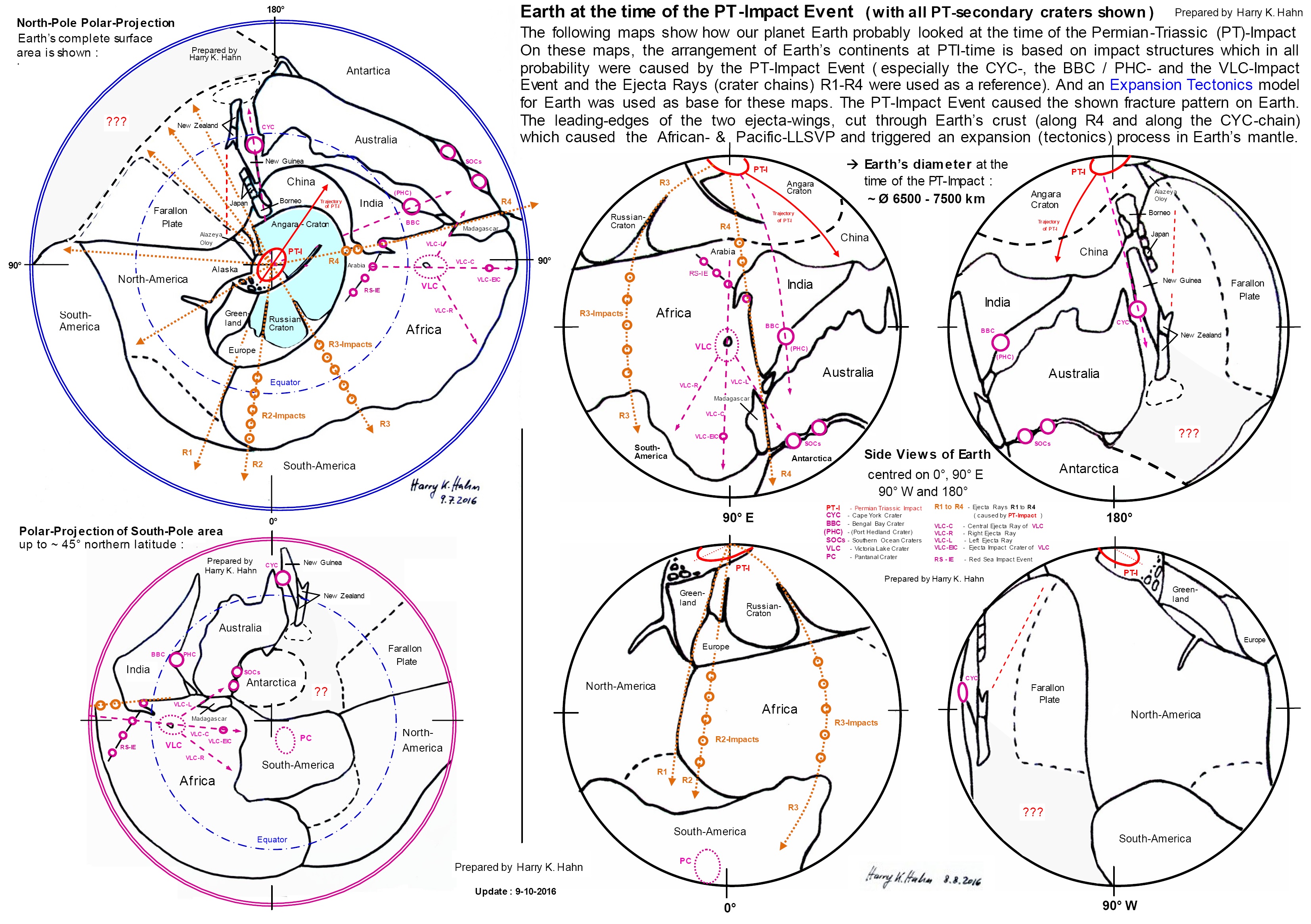
This is a supplement document to my Summary of geophysical evidence for the Ø1270 x 950km Permian Triassic (PT)-Impact-Crater (see Part 6 of my hypothesis). The purpose of this document is to point-out the main geo-physical features visible on our planet Earth, that were directly caused by the Permian-Triassic Impact-Event.
A comparison of the real PT-Crater-topography with a computer-simulated-topography indicates a Probability >99,99997% for the real existence of the PT-Crater !
► Another version of the above shown image :
-----------------------------------------------------------------------------------------------------------------------------------------------------------------
--------------------------------------------------------------------------------------------------------------------------------------------------------------------------------------------------------------------------------
--------------------------------------------------------------------------------------------------------------------------------------------------------------------------------------------------------------------------------
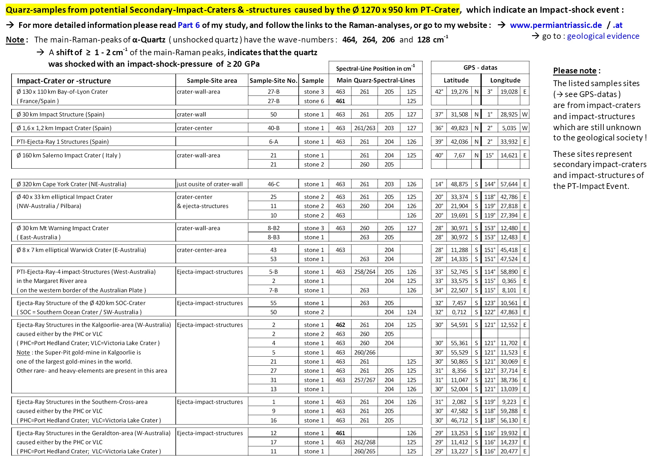
For more detailed information please see my website : à Geological Evidence for the PT-Impact Event and follow the links to the Raman-analyses
--------------------------------------------------------------------------------------------------------------------------------------------------------------------------------------------------------
------------------------------------------------------------------------------------------------------------------------------------------------------------------------------------------------------
------------------------------------------------------------------------------------------------------------------------------------------------------------------------------------------------------
Further I want to inform about two other possible impact-structures on Earth, which I believe are a result of the global PT-Impact Event too :
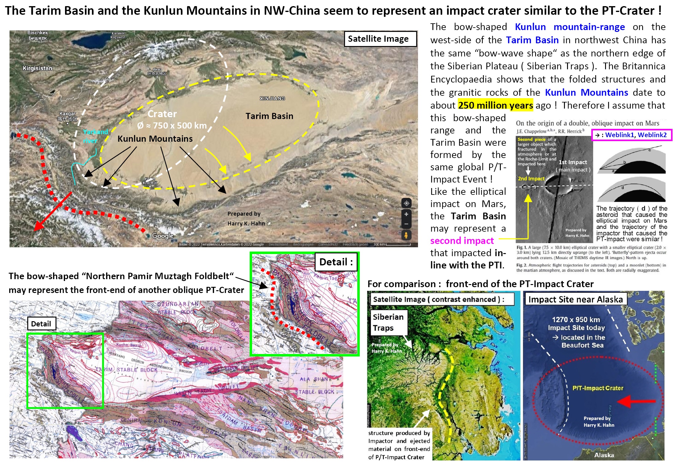
The first structure seems to be a “smaller-twin” of the PT-Impact Crater. It is the Tarim Basin in NW-China. The Kunlun Mountains around it indicate an age of 250 Ma !
The Tarim-Basin has an approximate elliptical shape with the dimensions of ≈ 900x400km ( see page 7-8 of Part 6c ). This basin probably was formed by a second impactor that impacted in-line with the main-impactor
which has caused the PT-Impact-Crater. The 900x400km elliptical Tarim-Basin probably had a shorter elliptical outline of around 750x500km shortly after the PT-Impact, but was then deformed later.
If we use a double-oblique elliptical impact-crater-twin on Mars as a reference, then the Tarim-Basin-Impact was caused by a similar effect as the smaller oblique impact crater of the Mars-Impact, which is located in-line with the bigger oblique-impact-crater but a bit uprange (ahead) of the main-impact-crater.
In the NASA-study about this double-oblique impact on Mars, as reason for this double-impact, the probable collapse (break-up into pieces) of the impactor shortly before the impact was mentioned. This collapse of the impactor just before the impact in all probability was caused by atmospheric effects (e.g. by the atmospheric impact-shock-wave which hit the impactor,
and atmospheric-drag etc.). Initial cracks inside the impactor probably already occurred when the impactor reached the “Roche-limit” of Mars (the point where gravitational forces start to rip the impactor apart).
.jpg)
-----------------------------------------------------------------------------------------------------------------------------------------------------------------------------------------------------------------------------
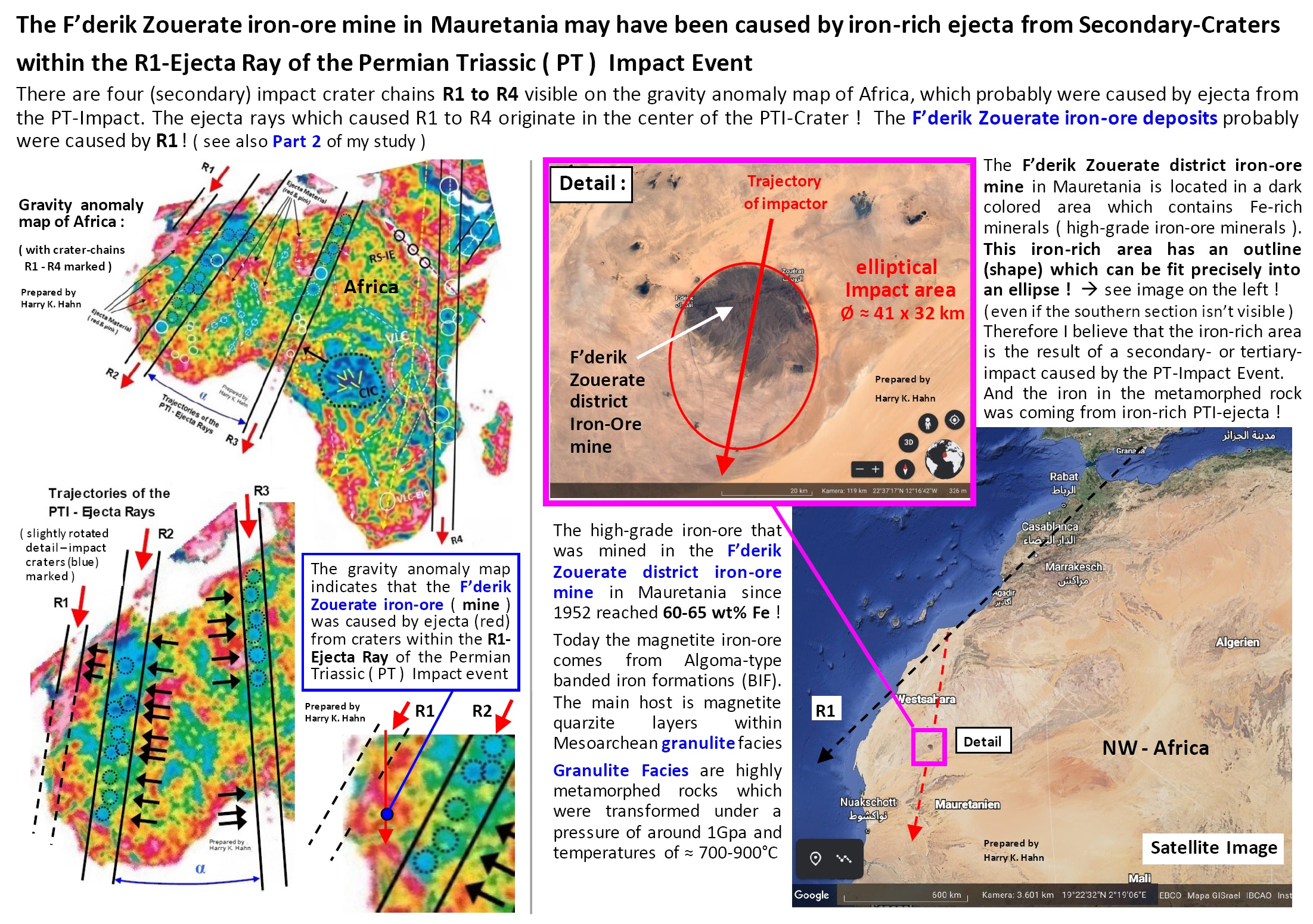
The other possible impact-structure which I want to describe is the 41x32km elliptical shaped F’derik Zouerate district Iron-ore-mine in Mauretania (NW-Africa).
It is located in a dark-colored-area which contains Fe-rich minerals. This iron-rich area has an outline which can be fit precisely into an ellipse !
That‘s why I believe that this iron-rich-area is the result of a secondary- or tertiary-impact in the PT-Ejecta Ray R1, which was caused by the PT-Impact Event and which runs along the NW-coast of Africa.
-------------------------------------------------------------------------------------------------------------------------------------------------------------------------------------------------------------------------------------
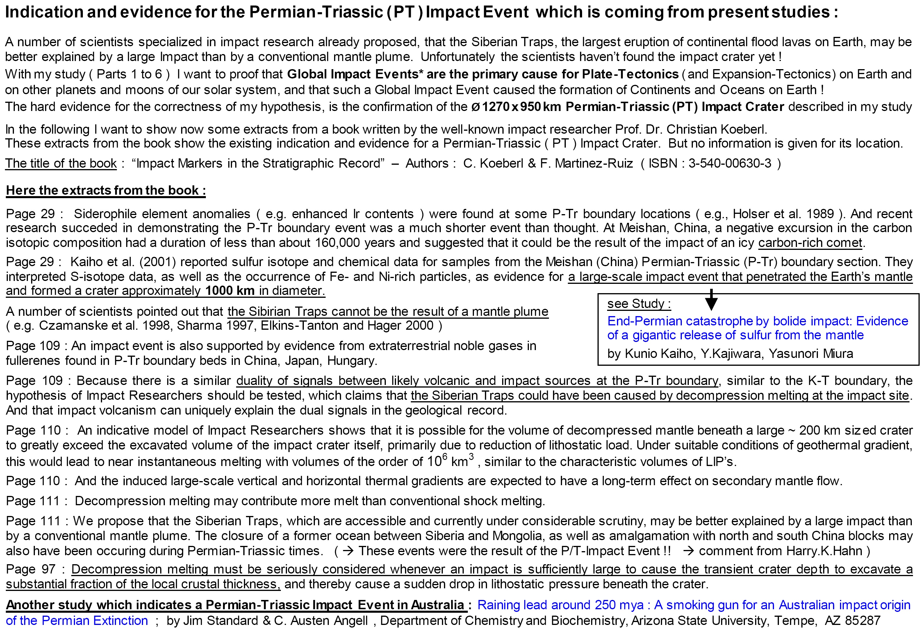
Iindication and evidence for the Permian-Triassic ( PT ) Impact Event which is coming frompresent studies. For example : Kunio Kaiho et al. (2001) reported sulfur isotope and chemical data for samples from the Meishan Permian-Triassic (P-Tr) boundary section ( China ). He interpreted the data as evidence for a large-scale impact event that penetrated
Earth's mantle and formed a crater approximately 1000 km in diameter :
-------------------------------------------------------------------------------------------------------------------------------------------------------------------------------------------------------------------------------